
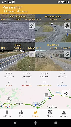
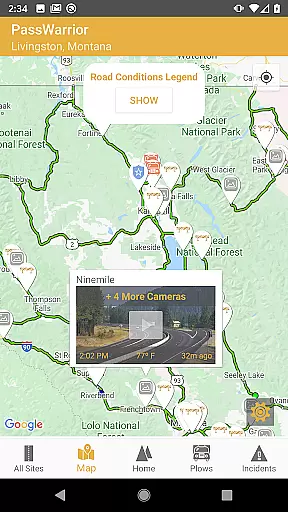
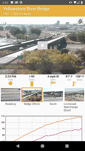
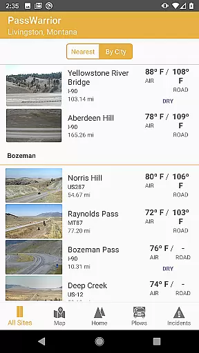
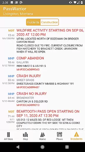
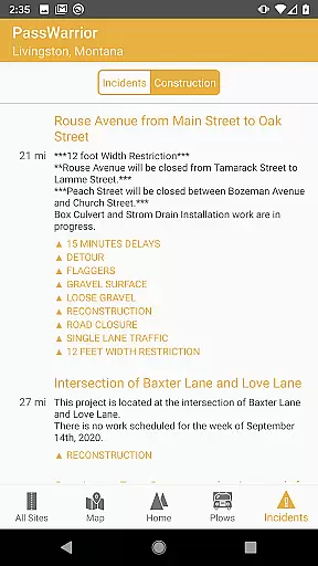
PassWarrior is a comprehensive travel companion app designed specifically for Montana road travelers. This essential tool provides real-time information on road conditions, weather updates, and traffic situations across Montana's highways and mountain passes.
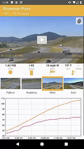
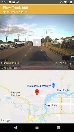
The app's core features include instant access to nearby road cameras, live dash cam feeds from active MDT plows, and timelapse videos of mountain pass conditions. Additionally, users can view current sensor readings, receive snow and ice warnings, check nearby incidents, and stay informed about active construction zones.
Perfect for both local commuters and visiting travelers, PassWarrior consolidates all crucial Montana Department of Transportation (MDT) information into one convenient location-based interface, making it an indispensable resource for safe and informed travel planning throughout Montana.
PassWarrior distinguishes itself through its comprehensive collection of real-time travel data features. The app's signature capability is its multi-source information system that combines various official MDT resources into one platform.
Key functionalities include geolocation-based camera identification, providing instant access to nearest road cams and mountain pass timelapses. The innovative plow tracking system lets users follow active MDT plows in real-time through their dash cams. Advanced weather monitoring features deliver current sensor readings alongside critical snow and ice warnings.
All features are thoughtfully integrated with location services, ensuring users receive the most relevant information based on their position within Montana's road network. The intuitive interface organizes complex data into easily digestible formats, enhancing user experience while maintaining information accuracy.
Booking authenticity is crucial for travelers who rely on accurate and trustworthy information to plan their journeys. PassWarrior - Montana provides real-time data directly from Montana Department of Transportation (MDT) sources, ensuring that users receive the most reliable road condition updates.
The app aggregates information from various MDT resources, presenting it in a unified interface. This consolidation allows users to instantly access the latest road cam images, active plow locations, and timelapse videos of mountain passes without navigating multiple websites.
Users benefit from verified and current road conditions, enabling them to make informed travel decisions. Whether planning a trip or responding to unexpected weather changes, PassWarrior's authentic data source gives drivers confidence in their route choices.
This commitment to providing genuine and timely information establishes PassWarrior as a dependable tool for Montana travelers, ensuring they have the necessary details to navigate safely through varying road conditions.
While PassWarrior - Montana focuses primarily on delivering essential travel information, price transparency remains an important aspect of any travel-related service. Although the app itself is free to use, it provides valuable insights that could lead to cost savings for its users.
The application delivers comprehensive details about road conditions, including sensor readings, snow and ice warnings, and construction zones. By having access to this information, users can avoid potentially costly situations such as vehicle damage from poor road conditions or unexpected delays.
PassWarrior helps travelers plan their routes more efficiently by offering instant access to the nearest road cams and active plow locations. This feature enables users to select optimal travel times and paths, potentially saving on fuel costs and reducing wear on their vehicles.
Although not directly related to pricing within the app, the transparency of road condition information indirectly contributes to users' financial planning by helping them anticipate and avoid expenses associated with challenging driving conditions.
User-friendly interface
Real-time data access
Comprehensive road info
Location-based services
Multiple viewing options
Montana-only coverage
Requires constant data
Dependent on MDT sources
No offline functionality
Specific use case focus

Explore our parks like never before with the completely reimagined Six Flags app
 4.30
4.30
Maps Speedometer shows your current speed in any app
3.60
View US public land boundary maps on your device.
3.70
Find the best prices, pay for the cheapest gas, and save on every fill up
3.30
Take your pick from over 5 million accommodation deals from major booking sites.
4.40
Vacationing on CARNIVAL? Maximize your fun on board with the ultimate cruise app
4.60
Book now to save with exclusive travel deals on hotels, flights, cars & packages
4.70
Rent the perfect car for wherever you’re going
4.90
Manage your travel on Delta with access to boarding passes, flight info & more.
4.80
Travel and Book 8,000+ Hotels Worldwide with the Marriott Bonvoy™ app.
4.90
One app, 300,000+ travel experiences, tours, and tickets you’ll remember.
4.90
Find your perfect somewhere with last minute hotel & travel deals!
4.80
Bus tickets at unbeatable prices with routes across the US. All aboard FlixBus!
4.70
Navigation on hikes is no longer a problem. Download the map, put notes and go!
4.60
The mobile panorama panel. Works offline - worldwide!
4.40
Iowa 511 is the Iowa Department of Transportation's traveler information app.
3.80
Examine the planet
3.80
Mix of explore game, travel mapping & tracking to memorize everywhere you go
3.60
Everything you need for your trip in one place with the Volaris app.
3.60


User Reviews